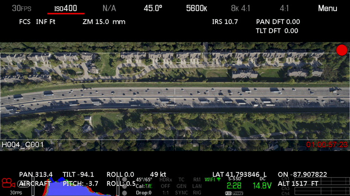
 Data collection from a moving helicopter on Chicago highway
Project Overview
The Third Generation SIMulation Data (TGSIM) project is a three-year research effort funded by the U.S. Department of Transportation (USDOT) to develop a comprehensive understanding of the impacts of automated driving systems on human behavior. The project is a led by Dr. Alireza Talebpour (UIUC), Dr. Hani Mahmassani (Northwestern) and Dr. Samer Hamdar (GWU).
The project aims to collect and process accurate trajectory datasets capable of characterizing human-automated vehicle interactions under a diverse set of scenarios in diverse highway and city environments. The datasets will be used to develop and validate traffic flow models that account for the impacts of automated driving systems on traffic flow. At the forefront of this project, I served as the leading graduate research assistant, playing a crucial role in developing a comprehensive data extraction pipeline that stands as a testament to our innovative approach to understanding the future of mobility.
Data Collecting Methodologies
Multiple methods were utilized to ensure comprehensive coverage of our study areas:
- Fixed location aerial videography: a helicopter hovers over a segment of interest.
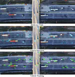
- Moving aerial videography: a helicopter tracks the automated vehicles as they navigate a longer roadway segment.
- Infrastructure-based videography: multiple overlapping cameras located on overpasses and buildings creating a comprehensive image of the study area.
Data Processing Pipeline
- Preprocessing:
- Raw Image Extraction: Converting the vedio into a sequence of frames separated at 30 fps over time.
- Reference Image Gereration: Developing a consistent methodology to convert each image into a fixed coordinate system (i.e., reference image).
- Object Detection: Leveraging RetinaNet and YOLOv5 for precise vehicle identification within each frame.
- Object Tracking: Performing a centroid tracking algorithm to trace vehicle trajectories through consecutive frames.
- Image Stabilization
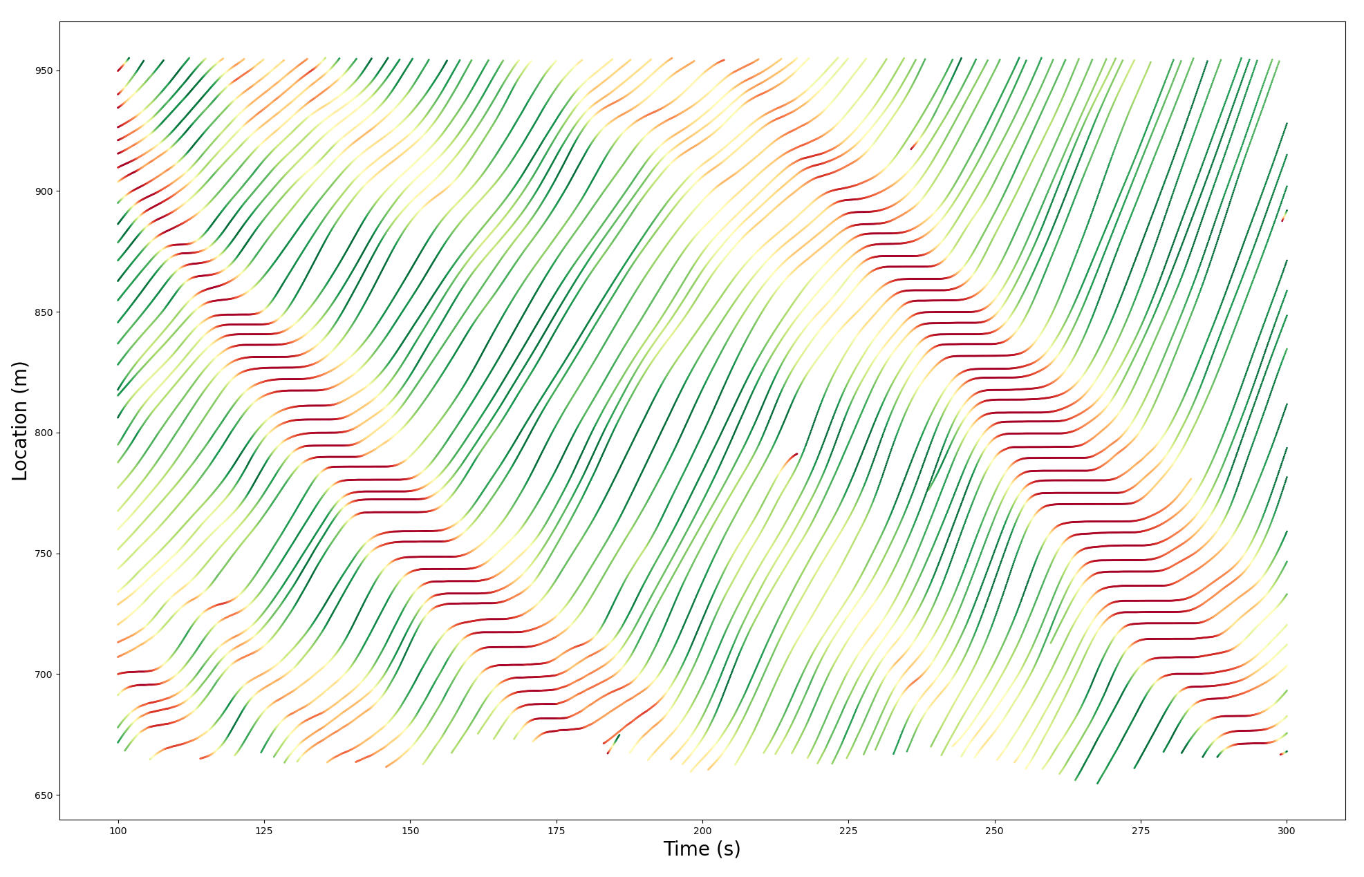
- Trajectory construction
Impact and Contribution
This data collection and processing approach enabled us to extract more than 11,000 vehicle-kilometers of high-fidelity trajectory data from 14 hours of video footage. My contributions not only facilitated the development of a data processing pipeline that is of precision but also paved the way for a deeper understanding of automated driving systems’ impact on traffic flow and human behaviors.
The datasets, poised to be released to the research community by June 2024 through the USDOT data portal.
Yanlin Zhang
Ph.D. Candidate
My research interests lies in the intersection of behavioral science and mixed autonomy traffic flow.